Cover Photo © G Harris WCS
Description
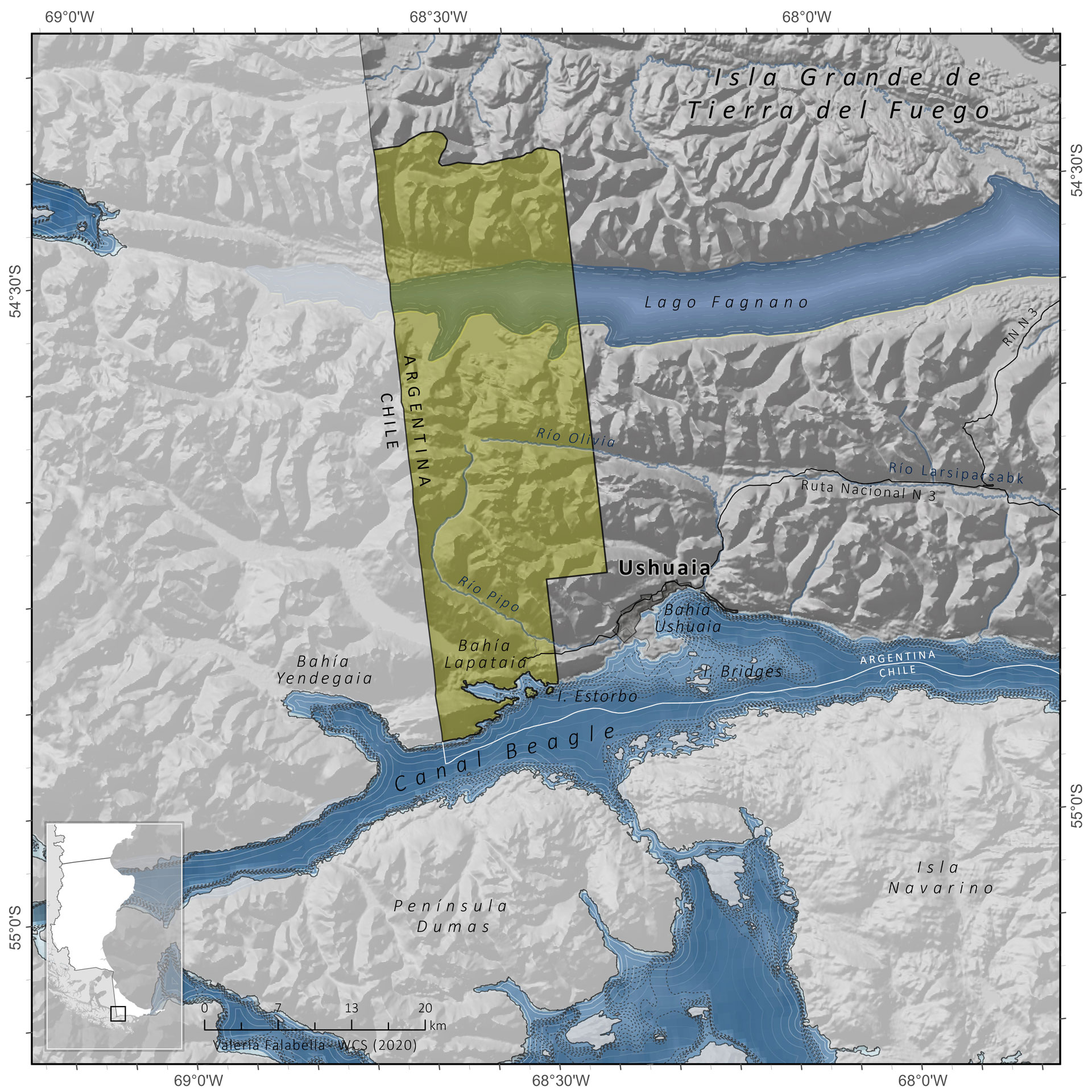
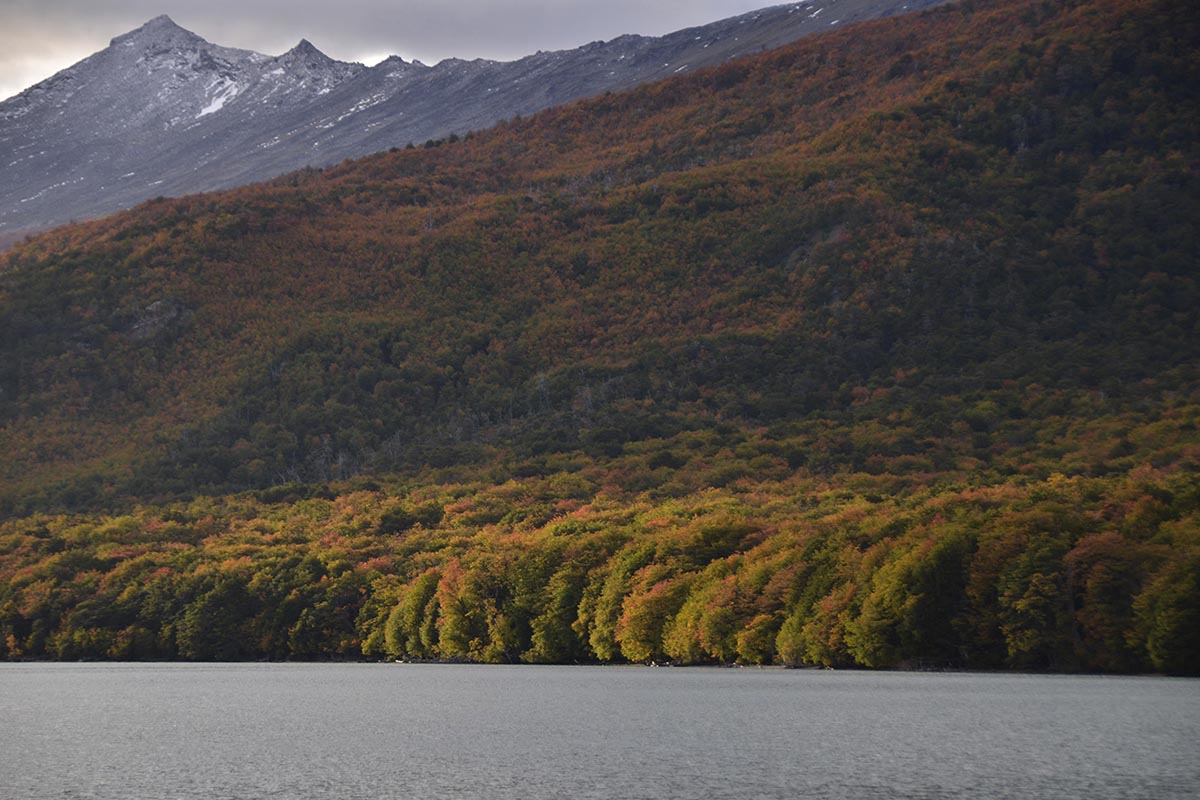
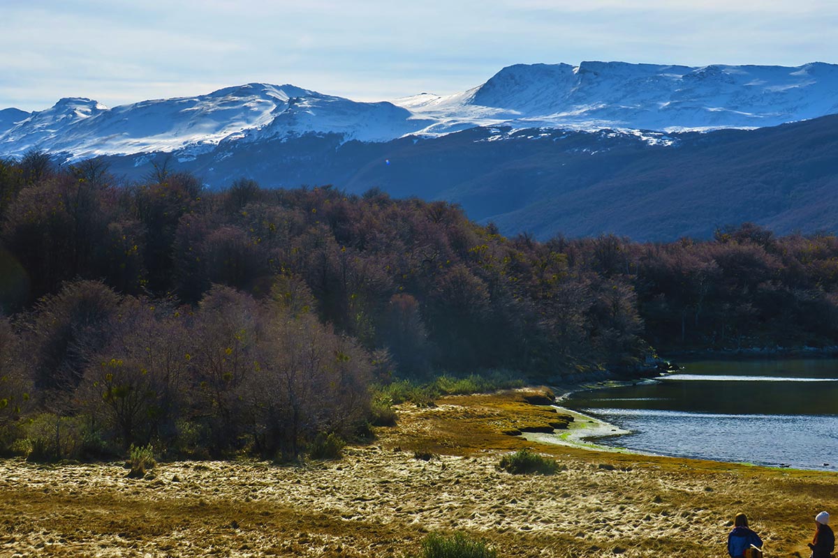
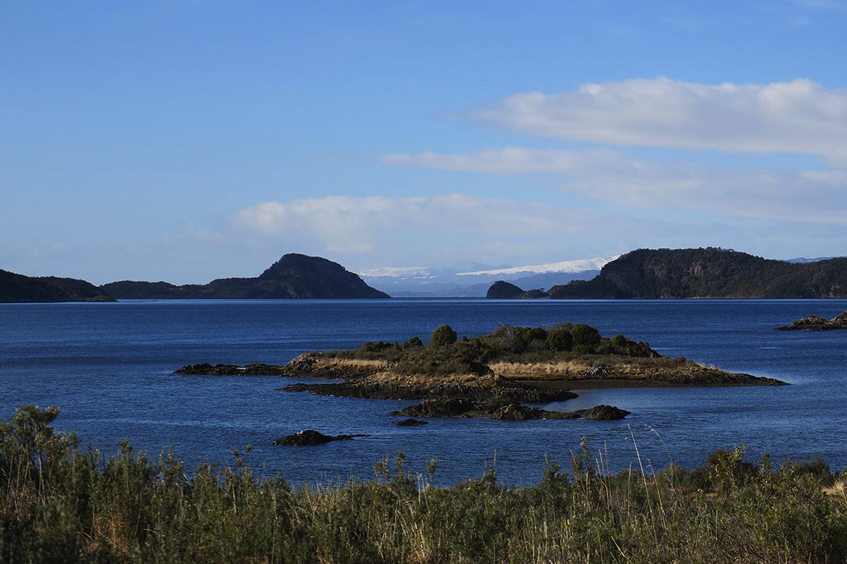
Tierra del Fuego National Park is located in the extreme southwest of the Province of Tierra del Fuego, from the Sierra de Beauvoir to the coast of the Beagle Channel. It is home to a representative sample of Magellanic forest that provides food and habitat for the reproduction and development of animal species, some of which have a high conservation value and a vulnerable and/or endangered status. The park constitutes a biological corridor for the Magellanic forest and its species because of its relationship with protected areas, which protects its unique scenic landscapes. The coastal marine environments are home to great biodiversity, nesting sites, breeding and reproduction of many species. Many of these environments are involved in recycling nutrients, regulating natural hazards, and mitigating the effects of climate change. The park also has different cultural values, including evidence of past human occupations, such as hunter-gatherer populations and human occupations in the late nineteenth and early twentieth centuries.
Geographic Location
Province
Tierra del Fuego
Coordinates
-54.86° Latitude S
-68.52° Longitude W
Size and Limits
Total Area:
Marine Area:
Continental Area:
NOTES ON SURFACE ESTIMATION
Area approximated and defined based on the calculation of the area of the polygon represented on the map (ArcGIS PRO) with an Albers Conic Equivalent Conic projection to preserve area calculations.
SIB reports 689.09 km2 (Read More).
Legal Aspects
Jurisdiction
National
Year of Creation
1960
Creation Legislation
National Law 1554/60
Eco-regions represented
Marine
–
Land
Patagonian Forrests Ecoregion
Conservation Objectives
Protection of a Fueguian forest sector with predominance of deciduous forests of Lenga Beech (Nothofagus pumilio) and Antarctic Beech (Nothofagus antártica). Protection of archaeological sites.
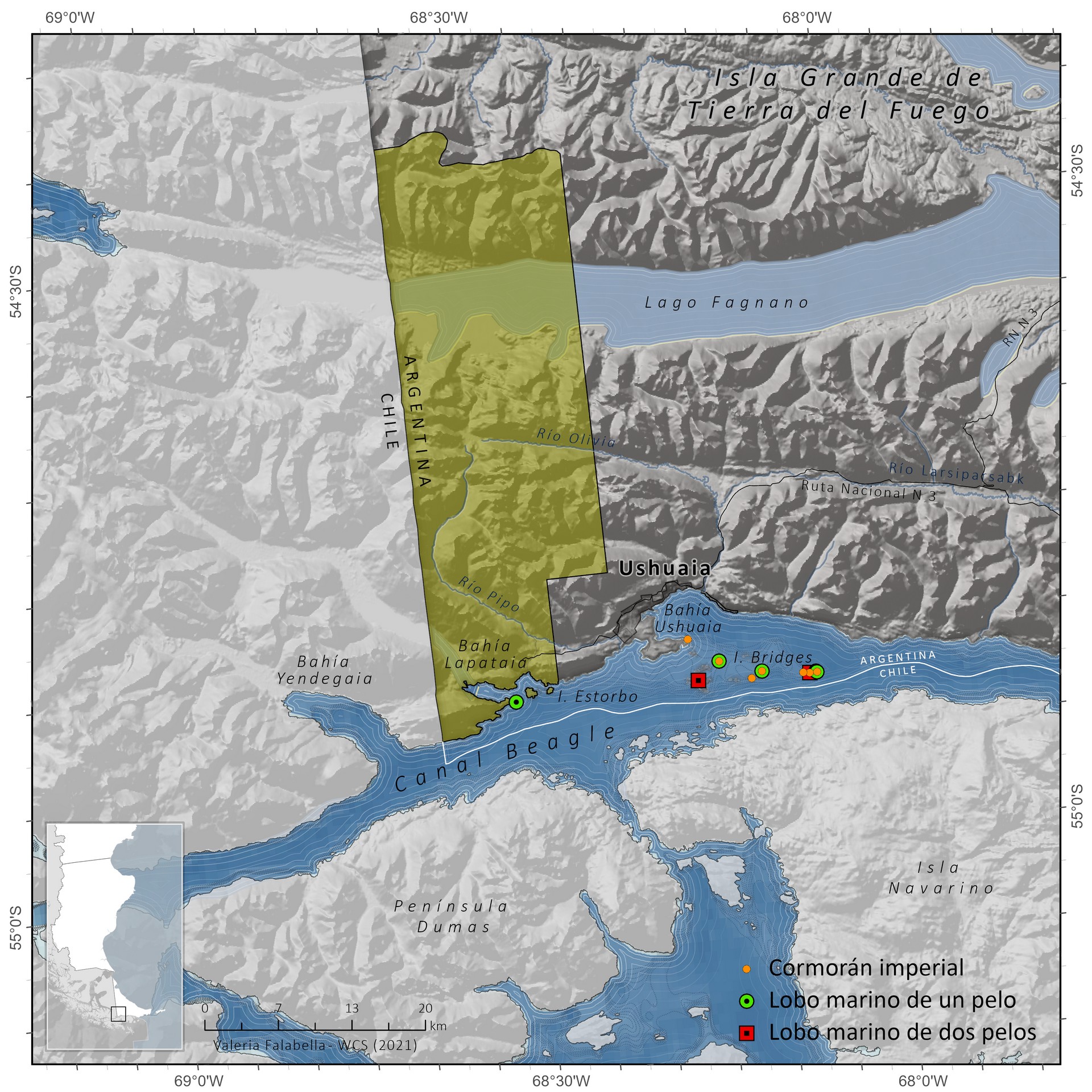
Conservation values
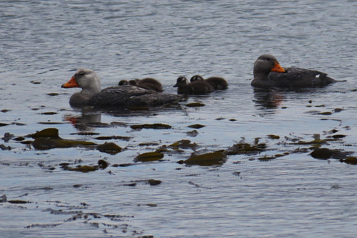
Species:
1. Huillín
2. Fuegian red fox
3. Guanaco
4. Flightless steamer duck
5. Caranca geese
6. Andean condor
7. Giant woodpecker
8. Austral carancho
9. White-fronted Caracara
10. Spiny porpoise
11. Patagonian agachona
12. Torrent ducks
13. Puyen chico
14. Spider crab
Ecosystems/communities:
Magellanic forest 2.
2. Guindo and cinnamon forest
3. Sphagnum peatlands
4. Cachiyuyo forests
5. Lapataia River Estuary
6. Coastal marine environment
7. Intertidal environment
8. Lapataia Bay and Zaratiegui Cove
9. High altitude ecosystem/environment
10. Headwaters of main hydrological basins
Geological landscape/paleontological resources:
Paleofiordo Lago Roca/Acigami-bahía 2.
2. Lapataia
3. Holocene terraces with associated paleofauna
4. Landscape of glacial origin
5. Lapataia geological formation
6. Glaciers
Management
Year of Management Plan approval
2020
Management effectiveness and evaluation year
Not evaluated.
Sources consulted:
Biodiversity Information System (see here).
Management Plan (2017)
Executive Summary Management Plan (2020)
Bird and marine mammal colonies: See Bibliography